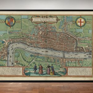
The central panorama section brings Old London Bridge and its Southwark approach into the foreground. The City spreads across the opposite bank, with its many churches rising above the houses. The image combines a wide river view with close architectural detail, making the bridge and the streets around it the natural focus.
Map Details
- Original panorama title: London, Westminster and Southwark as They Appeared in 1543
- Original draughtsman: Anthonis van den Wyngaerde
- Original studies: About 1544; traditionally titled 1543
- Version reproduced: A later reproduction of the Tudor panorama; the precise reproduction issue is not established
- Section: 2 of three sections offered in this collection
- Area shown: Old London Bridge, Southwark and the City of London
- Print size: 29.5″ × 17″
A bridge lined with buildings
The crossing is drawn as a built-up street over the river. Its houses, gates and supporting piers give it a substantial architectural presence. Seen at an angle, the bridge links the near-bank streets with the City waterfront and draws the eye into the wider scene.
Small boats share the Thames with larger sailing vessels. Their different sizes and positions help convey the breadth of the river, while the bridge’s closely grouped buildings emphasise the contrast between open water and crowded streets.
Southwark in the foreground
St Mary Overies stands beside the bridge approach, with its tower clearly visible. Nearby houses, larger residences and garden plots give the south bank a varied appearance. The contemporary names Winchester House and Rochester House, identified in the published commentary on this section, refer to the residences of the respective bishops.
Across the water, the City forms a dense band of roofs punctuated by towers and spires. Old St Paul’s appears at the left of the section. The panorama lets the viewer compare the scale of its great churches with the smaller buildings around them.
The date behind the traditional title
Wyngaerde drew the original panorama in the sixteenth century. The title uses 1543, but the Government Art Collection dates his studies to about 1544. This fine art print reproduces a later published version of that Tudor drawing; its precise publication date has not been established.
Supplied unframed. This central section can be displayed individually or with the adjoining western and eastern sections.