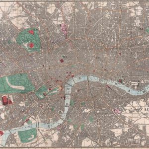
Originally published in 1832 by Baldwin & Cradock, who were based at 47 Paternoster Row, London for the “Society for the Diffusion of Useful Knowledge.” A rare map of the UK capital illustrating from Hampton Court Park and Kingston in the southwest to Stanmore in the northwest and from Kevington and St. Mary’s Cray in the southeast across to the north easterly Hennault Forest. The red circle in the centre of the map highlights the area covered by the two penny post delivery system at the time. The plan is intricately detailed depicting individual buildings, shops, farms, factories, palaces and much more. Nowadays, SDUK are thought by many to have produced some of the most impressive mid-19th century maps and the society is renowned for its stunningly accurate city plans.
Size: 17″ x 20″
* price shown is for print only


