
VIEW AN INDEX OF THE FULL SERIES HERE
The Old London Map Company are pleased to offer this fine art reproduction sympathetically enhanced and digitalised from the original to a standard equalling museum quality. This map was originally published by Edward Stanford in 1872. Like the other sheets in the series, it originally formed part of a 24-sheet large-scale map depicting London and its surroundings during the late Victorian era. Now produced in individual editions so you can enjoy a finished piece featuring the particular area of interest within Victorian London.
Overview
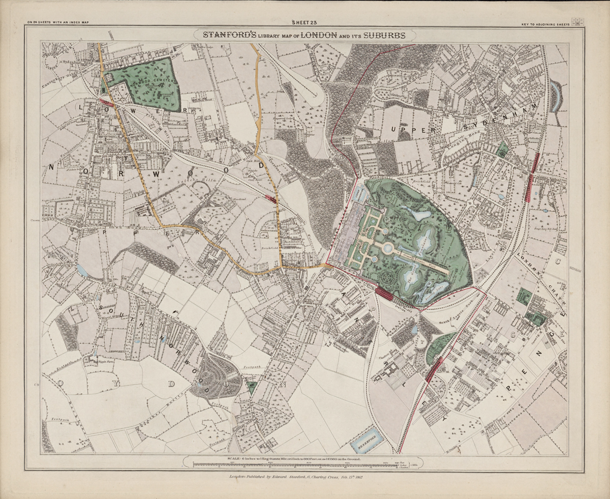
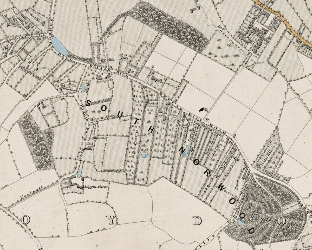
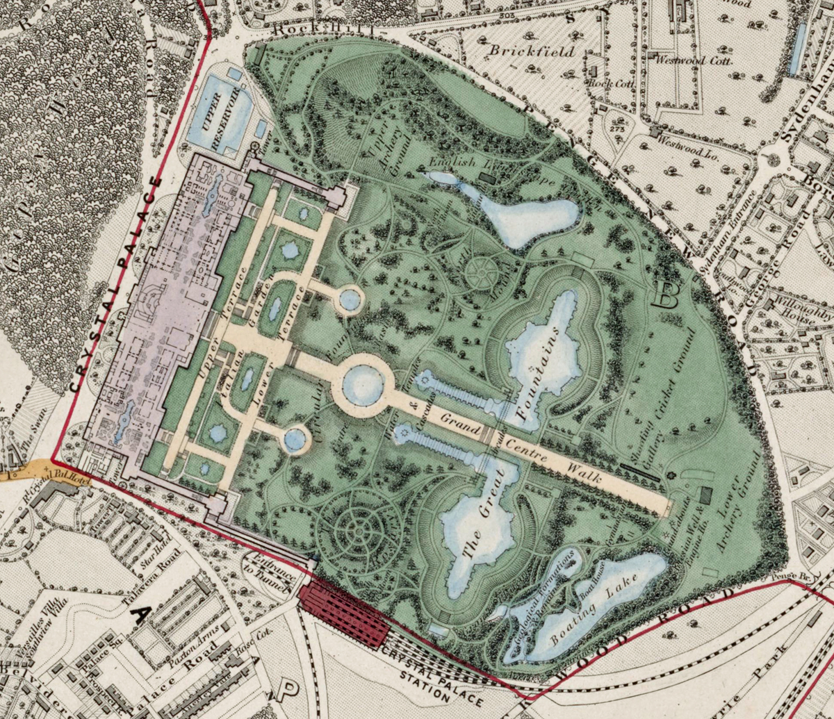
Sheet 23 showcases the district of Upper Norwood, Lower Norwood, and the surrounding areas of South London, including the prominent grounds of the Crystal Palace. During the early 1870s, this district was a developing suburban area, celebrated for the Crystal Palace parklands and its elevated, leafy environment.
Cartographic Details
- Engraved line work with fine hand colouring, a hallmark of Stanford’s mapmaking.
• The Crystal Palace and its landscaped grounds are prominently depicted in green and pink, reflecting their status as a major London landmark.
• Railway connections, including the Crystal Palace line, are clearly marked, highlighting the area’s accessibility.
Administrative and Postal Features
- This sheet lies within the South Eastern (SE) postal district established in the mid-19th century.
• Red boundary lines show parish and district borders predating the modern borough system.
Original Size
The complete Stanford’s Library Map measured about 9 × 12 feet (approximately 2.7 × 3.7 m) when all 24 sheets were assembled. Each individual sheet, including Sheet 1, was printed on paper roughly 18 × 24 inches (about 46 × 61 cm) which we supply as our Medium size but due to the quality of our scanning process we are also able to offer a larger edition at 24 x 29 inches (about 61 × 73.5 cm) printed on conservation grade paper.
Modern Postcode Coverage
Today, the area covered by Sheet 23 aligns roughly with the following Royal Mail postcode districts:
• SE19 – Upper Norwood, Crystal Palace
• SE20 – Penge (eastern fringe)
• SE25 – South Norwood (north-east edge)
• SW16 – Streatham (western edge)
• CR7 – Thornton Heath (south-west fringe)
Twenty Major Places Shown on the Map
Notable locations visible include:
1. The Crystal Palace
2. Crystal Palace Park
3. Upper Norwood
4. Lower Norwood
5. Norwood New Town
6. Gipsy Hill
7. Penge (eastern edge)
8. Anerley (north-east corner)
9. St John’s Church, Upper Norwood
10. All Saints Church, Upper Norwood
11. Westow Hill
12. Westow Park
13. Norwood Cemetery
14. Beulah Spa (historical site)
15. Grange Wood
16. Norwood Grove
17. Church Road district
18. Norwood Junction (railway line access)
19. Gipsy Road area
20. South Norwood Hill
Twenty Major Roads and Thoroughfares Shown
Prominent streets and routes include:
1. Church Road
2. Gipsy Hill
3. Central Hill
4. Westow Hill
5. Westow Street
6. Westow Park Road
7. Anerley Road
8. Beulah Hill
9. Crystal Palace Parade
10. South Norwood Hill
11. Penge Road
12. Crown Dale
13. Elder Road
14. Auckland Road
15. Belvedere Road
16. Hamlet Road
17. Central Avenue
18. Woodland Road
19. Westwood Hill
20. Crystal Palace Park Road