
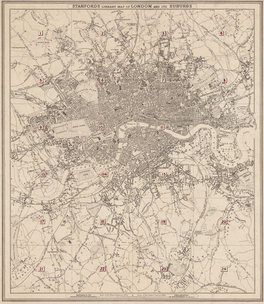
First published by Edward Stanford on 15 February 1862,
Stanford’s Library Map of London and Its Suburbs
records the capital and its surrounding districts in remarkable
street-by-street detail. The complete map was issued across 24
adjoining, individually hand-coloured sheets.
Each sheet is available separately as a fine art print, allowing
you to choose the particular part of Victorian London that holds
the greatest personal or historical interest.
Edward Stanford · London, 1862 · 24 sheets · Scale: six inches to one mile
Find Your Part of Victorian London
Select a numbered area on the map, or choose a locality below.
Sheet 1
Hendon, Hampstead, Golders Green and Cricklewood
View this map →
Sheet 2
Highgate, Kentish Town and Crouch End
View this map →
Sheet 3
Stoke Newington, Upper Clapton and Hackney
View this map →
Sheet 4
Walthamstow, Leyton and Wanstead
View this map →
Sheet 5
Kilburn, St John’s Wood and Kensal Green
View this map →
Sheet 6
Regent’s Park, Camden and Marylebone
View this map →
Sheet 7
Canonbury, Hoxton and Bethnal Green
View this map →
Sheet 8
Hackney Wick, Bow and Stratford
View this map →
Sheet 9
Kensington, Notting Hill and Shepherd’s Bush
View this map →
Sheet 10
Westminster and Mayfair
View this map →
Sheet 11
City of London, Whitechapel and Wapping
View this map →
Sheet 12
Limehouse and the Isle of Dogs
View this map →
Sheet 13
Fulham, Parsons Green and Chelsea
View this map →
Sheet 14
Chelsea, Battersea Park and Kennington
View this map →
Sheet 15
Walworth, Camberwell and Peckham
View this map →
Sheet 16
Greenwich, Deptford and Blackheath
View this map →
Sheet 17
Wandsworth and Putney
View this map →
Sheet 18
Clapham, Balham and Tooting
View this map →
Sheet 19
Dulwich, Herne Hill and Forest Hill
View this map →
Sheet 20
Lewisham, Lee and Eltham
View this map →
Sheet 21
Wimbledon and Merton
View this map →
Sheet 22
Streatham, Tooting and Mitcham
View this map →