


VIEW AN INDEX OF THE FULL SERIES HERE
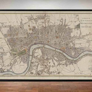
The Old London Map Company are pleased to offer this fine art reproduction sympathetically enhanced and digitalised from the original to a standard equalling museum quality. This map was originally published by Edward Stanford in 1872. Like the other sheets in the series, it originally formed part of a 24-sheet large-scale map depicting London and its surroundings during the late Victorian era. Now produced in individual editions so you can enjoy a finished piece featuring the particular area of interest within Victorian London.
Overview
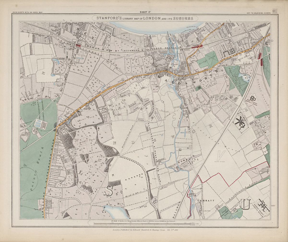
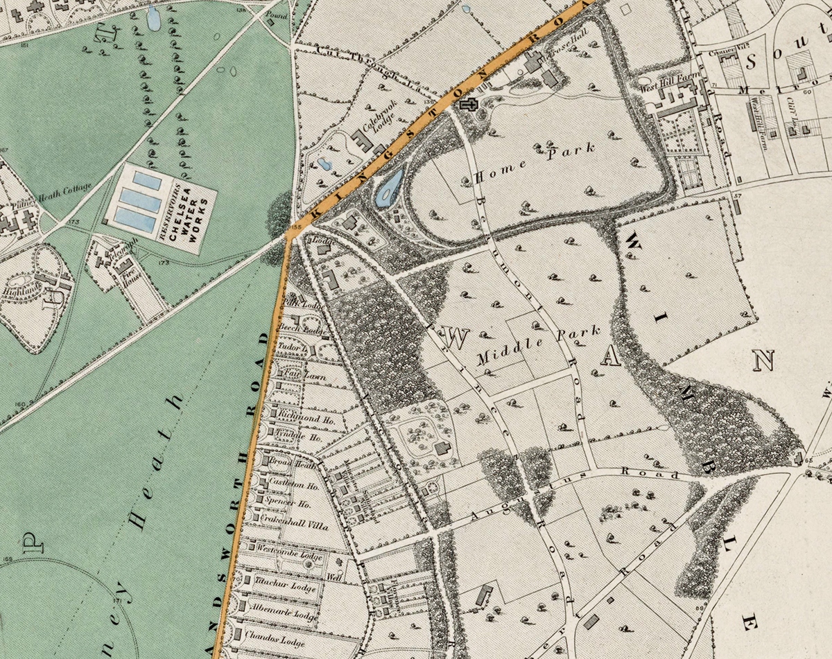
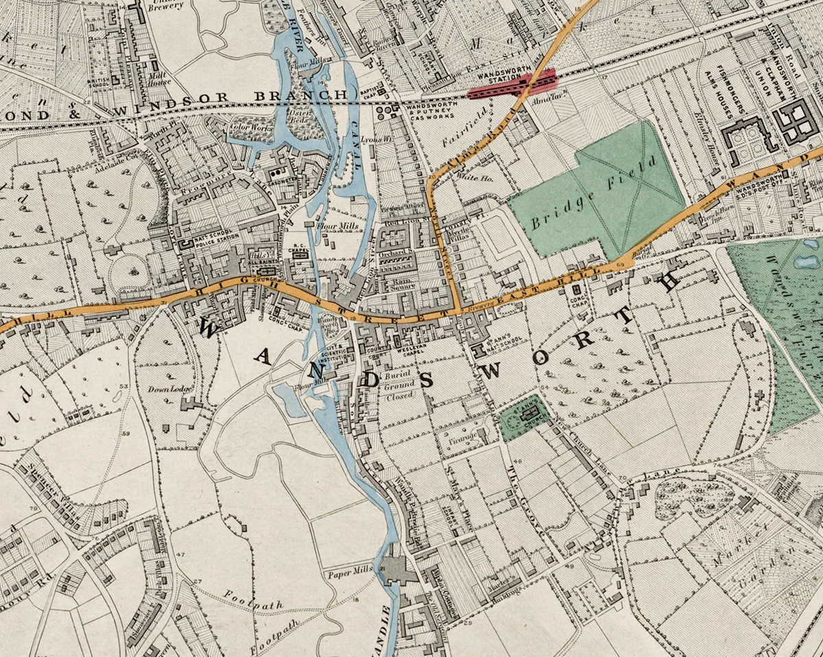
Sheet 17 depicts the south-western outskirts of London, covering Wandsworth, Earlsfield, and the approach to Richmond and Wimbledon. In the early 1870s this area retained a largely rural character with open fields, market gardens, and large estates, though railway development was beginning to encourage suburban growth.
Cartographic Details
- Fine engraved line work with delicate hand colouring typical of Stanford’s maps.
• Extensive green spaces, including Wandsworth Common and Putney Heath, are carefully shaded.
• Early railway lines such as the London and South Western Railway are shown linking the villages to central London.
Administrative and Postal Features
- The sheet lies primarily within the South Western (SW) postal district created by mid-19th-century reforms.
• Red boundary lines denote parish and district borders, reflecting the administrative geography before the creation of modern boroughs.
Original Size
The complete Stanford’s Library Map measured about 9 × 12 feet (approximately 2.7 × 3.7 m) when all 24 sheets were assembled. Each individual sheet, including Sheet 1, was printed on paper roughly 18 × 24 inches (about 46 × 61 cm) which we supply as our Medium size but due to the quality of our scanning process we are also able to offer a larger edition at 24 x 29 inches (about 61 × 73.5 cm) printed on conservation grade paper.
Modern Postcode Coverage
Today, this area corresponds largely to the following modern Royal Mail postcode districts:
• SW18 – Wandsworth, Earlsfield
• SW19 – Wimbledon (northern sections)
• SW15 – Putney (western edge)
• SW20 – Raynes Park (southern fringe)
• SW17 – Tooting (eastern edge)
• SW14 – Mortlake (north-west corner)
Twenty Major Places Shown on the Map
Notable locations visible include:
1. Wandsworth Common
2. Earlsfield Station (early railway stop)
3. Wandsworth Prison (then Surrey House of Correction)
4. Wandle River and mills
5. Garratt Green
6. Wimbledon Park (northern outskirts)
7. Putney Heath (western edge)
8. King George’s Park (later development site)
9. St Anne’s Church, Wandsworth
10. St Mary’s Church, Summerstown
11. St Mary’s Church, Putney (edge of sheet)
12. Merton Priory remains (southern fringe)
13. River Thames (north-west corner)
14. All Saints Church, Wandsworth
15. Wandsworth Gas Works
16. Surrey Iron Railway remnants
17. Tooting Graveney (eastern edge)
18. Earlsfield House estate
19. Springfield Hospital grounds (north-east corner)
20. The Beverley Brook
Twenty Major Roads and Thoroughfares Shown
Prominent streets and routes include:
1. Garratt Lane
2. Wandsworth High Street
3. East Hill
4. Upper Richmond Road
5. West Hill
6. Putney Hill (western edge)
7. Trinity Road
8. Tooting High Street (eastern edge)
9. Merton Road
10. Wimbledon Park Road
11. Earlsfield Road
12. Burntwood Lane
13. Magdalen Road
14. Armoury Way
15. Swandon Way (later alignment shown as earlier roads)
16. King’s Road (Putney approach)
17. Durnsford Road
18. Blackshaw Road
19. Kimber Road
20. Plough Lane
In summary, Sheet 17 captures the semi-rural landscapes of south-west London in the 1870s, documenting the early stages of suburban development that would soon transform the Wandsworth and Wimbledon districts.