


VIEW AN INDEX OF THE FULL SERIES HERE
The Old London Map Company are pleased to offer this fine art reproduction sympathetically enhanced and digitalised from the original to a standard equalling museum quality. This map was originally published by Edward Stanford in 1872. Like the other sheets in the series, it originally formed part of a 24-sheet large-scale map depicting London and its surroundings during the late Victorian era. Now produced in individual editions so you can enjoy a finished piece featuring the particular area of interest within Victorian London.
Overview
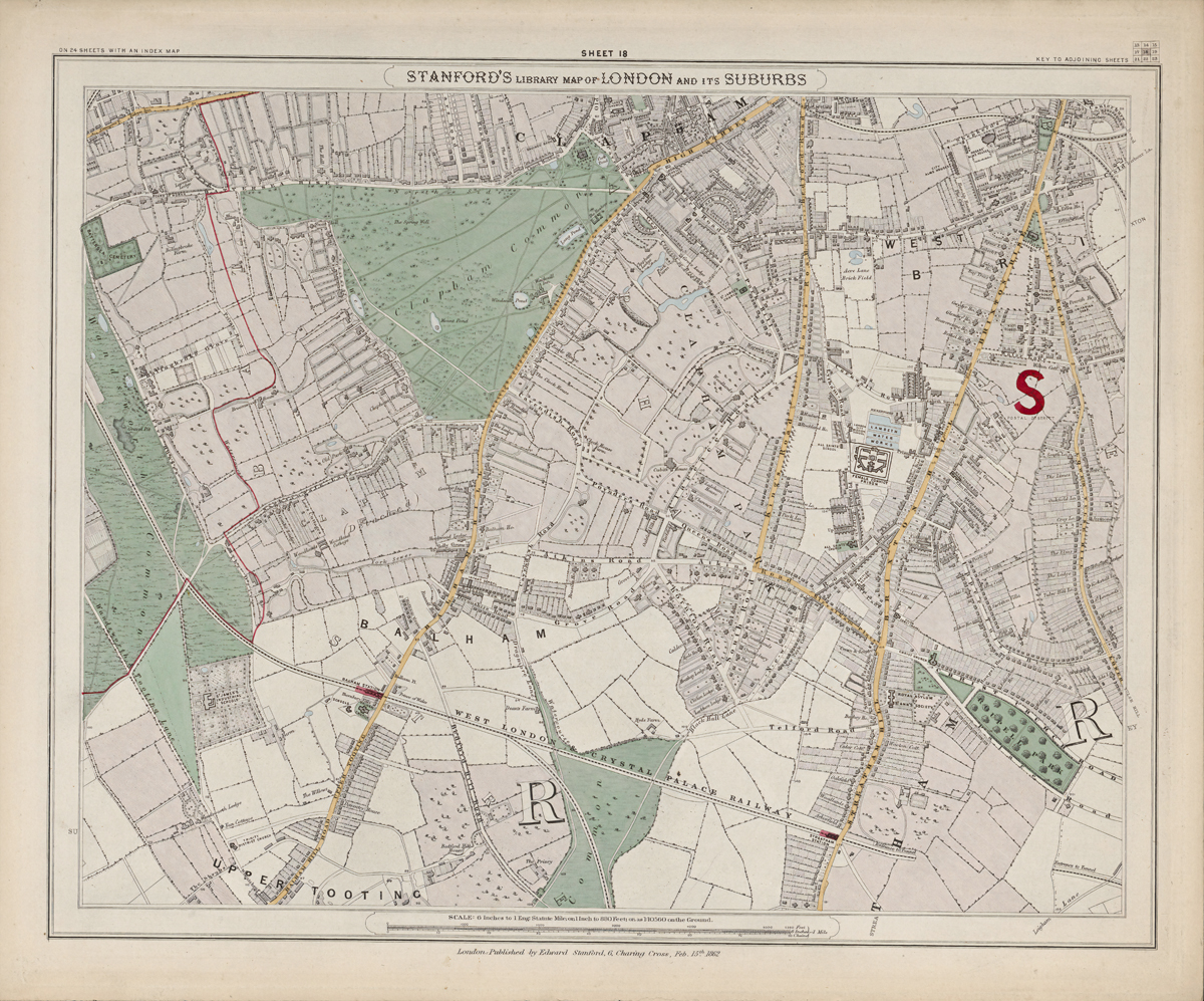
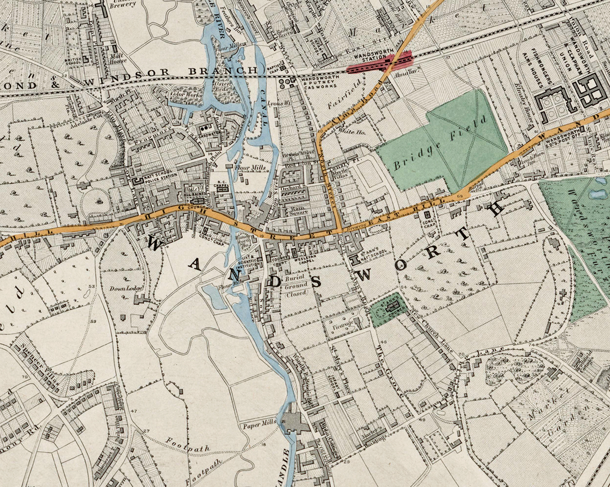
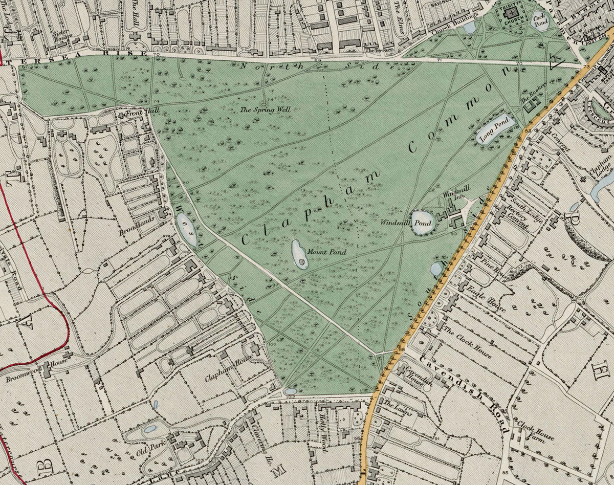
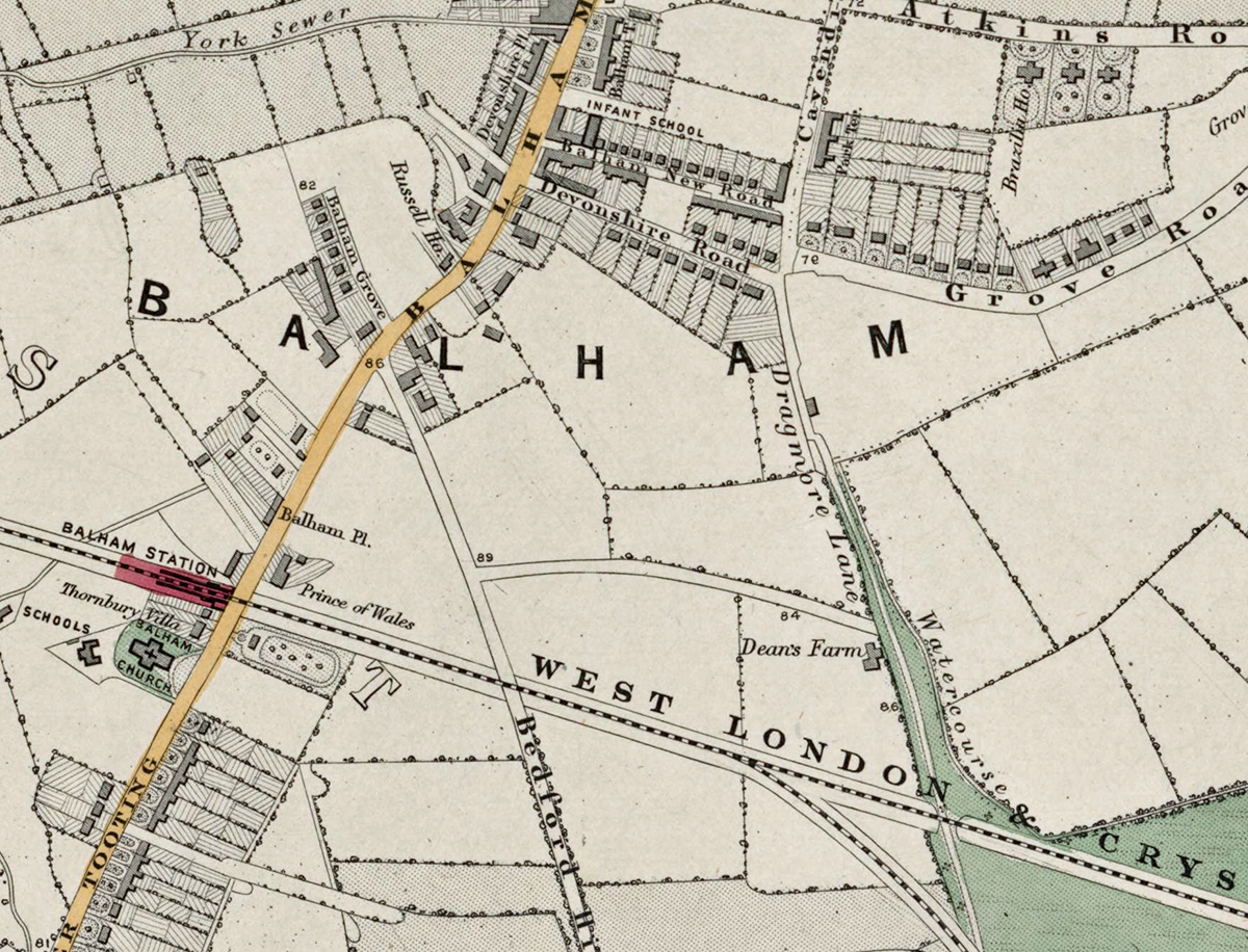
Sheet 18 shows the southern districts between Clapham, Balham, Tooting, Streatham, and the western edge of Norwood. In the early 1870s this area was a patchwork of open farmland, commons, and developing suburban streets, with key railway lines already encouraging residential growth.
Cartographic Details
-
Fine engraved line work with delicate hand-colouring typical of Stanford’s maps.
-
Large green spaces, including Clapham Common, Tooting Common, and smaller ornamental grounds, are carefully shaded.
-
The London, Brighton & South Coast Railway and other branch lines are clearly drawn, linking these once-rural villages to central London.
Administrative and Postal Features
-
The sheet lies mainly within the South Western (SW) and South Eastern (SE) postal districts established by mid-19th-century reforms.
-
Red boundary lines denote parish and district borders, reflecting the administrative geography before the creation of modern London boroughs.
Original Size
The complete Stanford’s Library Map measured about 9 × 12 feet (approximately 2.7 × 3.7 m) when all 24 sheets were assembled. Each individual sheet, including Sheet 1, was printed on paper roughly 18 × 24 inches (about 46 × 61 cm) which we supply as our Medium size but due to the quality of our scanning process we are also able to offer a larger edition at 24 x 29 inches (about 61 × 73.5 cm) printed on conservation grade paper.
Modern Postcode Coverage
Today, this area corresponds largely to the following modern Royal Mail postcode districts:
-
SW4 – Clapham
-
SW12 – Balham
-
SW17 – Tooting
-
SW16 – Streatham
-
SW2 – Brixton Hill/Streatham Hill fringe
Twenty Major Places Shown on the Map
Notable locations visible include:
-
Clapham Common
-
Balham Station (early railway stop)
-
Tooting Bec Common
-
Streatham Common (south-east corner)
-
Bedford Hill area
-
Nightingale Lane
-
Holy Trinity Church, Clapham
-
St Mary’s Church, Balham
-
St Leonard’s Church, Streatham
-
Clapham Park Estate
-
Springfield Hospital (western fringe)
-
Lido site (later development on Tooting Common)
-
Clapham South Road
-
Trinity Road (Wandsworth link)
-
Bedford Estate lands
-
The River Graveney
-
Mitcham Lane
-
Streatham Hill Station
-
Balham Hill
-
Tooting Broadway (future Underground site)
Twenty Major Roads and Thoroughfares Shown
Prominent streets and routes include:
-
Clapham High Street
-
Balham High Road
-
Streatham High Road
-
Bedford Hill
-
Nightingale Lane
-
Clapham Park Road
-
Trinity Road
-
Cavendish Road
-
Ritherdon Road
-
Oldridge Road
-
Mitcham Lane
-
Leigham Court Road
-
Streatham Hill
-
Atkins Road
-
Poynders Road
-
Clarence Avenue
-
Kings Avenue
-
Abbeville Road
-
Tooting Bec Road
-
Garratt Lane (northern link)
In summary, Sheet 18 captures a transitional landscape where open commons and farmland were rapidly giving way to Victorian suburban streets, illustrating the south-London growth corridor that would soon create the continuous cityscape we know today.