


VIEW AN INDEX OF THE FULL SERIES HERE
The Old London Map Company are pleased to offer this fine art reproduction sympathetically enhanced and digitalised from the original to a standard equalling museum quality. This map was originally published by Edward Stanford in 1872. Like the other sheets in the series, it originally formed part of a 24-sheet large-scale map depicting London and its surroundings during the late Victorian era. Now produced in individual editions so you can enjoy a finished piece featuring the particular area of interest within Victorian London.
Overview
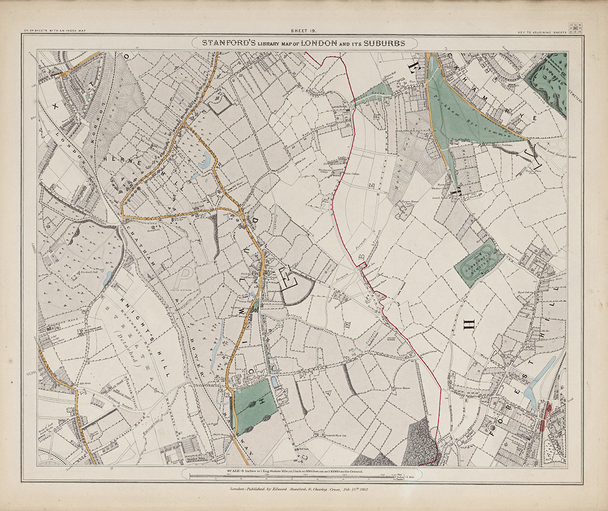
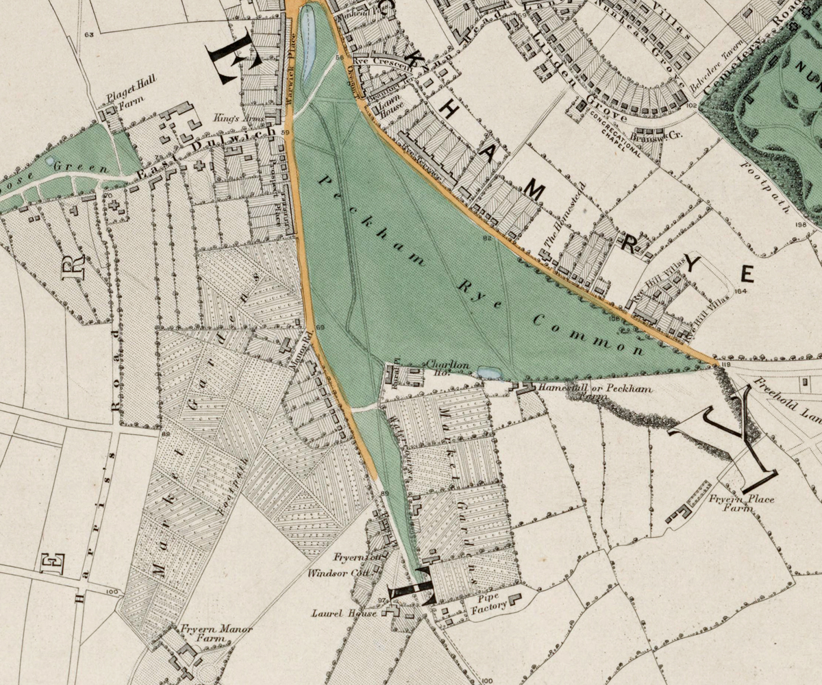
Sheet 19 illustrates the southern suburbs of London around Herne Hill, Dulwich, and parts of Sydenham. In the early 1870s, these districts retained a semi-rural character with large private estates, woodlands, and parks, but railway expansion was beginning to bring suburban residential development.
Cartographic Details
- Fine engraved line work and subtle hand colouring typical of Stanford’s high-quality maps.
• Large green spaces such as Dulwich Wood, Sydenham Hill, and Brockwell Park are clearly delineated.
• Early railway lines and stations are marked, indicating the growing connectivity of these outer districts.
Administrative and Postal Features
- This area fell within the South Eastern (SE) postal district introduced in the mid-19th century.
• Red boundary lines show parish and district divisions as they existed before the formation of the modern London boroughs.
Original Size
The complete Stanford’s Library Map measured about 9 × 12 feet (approximately 2.7 × 3.7 m) when all 24 sheets were assembled. Each individual sheet, including Sheet 1, was printed on paper roughly 18 × 24 inches (about 46 × 61 cm) which we supply as our Medium size but due to the quality of our scanning process we are also able to offer a larger edition at 24 x 29 inches (about 61 × 73.5 cm) printed on conservation grade paper.
Modern Postcode Coverage
Today, this region of south London corresponds largely to the following Royal Mail postcode districts:
• SE21 – Dulwich
• SE24 – Herne Hill
• SE22 – East Dulwich (northern edge)
• SE19 – Upper Norwood (south-west corner)
• SE26 – Sydenham (south-east fringe)
Twenty Major Places Shown on the Map
Notable locations visible include:
1. Dulwich College
2. Dulwich Park (then in planning, area shown as Dulwich Common)
3. Dulwich Village
4. Herne Hill
5. Brockwell Park (northern edge)
6. Sydenham Hill Wood
7. Crystal Palace (just off sheet to south-west, related grounds indicated)
8. Horniman Gardens site (future museum site)
9. St Barnabas Church, Dulwich
10. All Saints Church, West Dulwich
11. Dulwich Wood House area
12. Lordship Lane (village centre)
13. Forest Hill (east fringe)
14. Knights Hill (west side)
15. Tulse Hill (north-west corner)
16. Belair House and grounds
17. Dulwich Picture Gallery
18. Cox’s Walk (woodland path)
19. College Road Tollgate
20. Dulwich Hospital (future site shown as open land)
Twenty Major Roads and Thoroughfares Shown
Prominent streets and routes include:
1. Lordship Lane
2. College Road
3. Dulwich Common Road
4. Sydenham Hill Road
5. Crystal Palace Road
6. Tulse Hill
7. Half Moon Lane
8. Croxted Road
9. Rosendale Road
10. Gallery Road
11. South Circular (future alignment shown as local roads)
12. Norwood Road
13. Knight’s Hill Road
14. Gipsy Road
15. Forest Hill Road
16. Peckarmans Wood Lane
17. Court Lane
18. Red Post Hill
19. Village Way
20. College Drive
In summary, Sheet 19 captures the picturesque semi-rural landscape of Dulwich and its surroundings in the 1870s, illustrating large private estates, woodlands, and the first suburban villas that foreshadowed later urban expansion.


