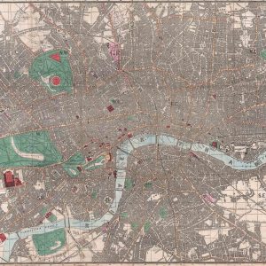
Drawn by Cram and published by his own firm, Cram & Co. in the final decade of the 19th century. It is an atlas map, depicting a bird’s eye view of the Great British capital and originally stood at 31cm x 51cm. As can be seen from the image opposite, this is perhaps one of the most exquisitely detailed maps in our collection, indicating down to roads, underground railways, principal buildings, parks, monuments and much more. It was published as part of a large world atlas produced in order to commemorate the 1893 World’s Fair and Columbian Exposition in Chicago for Woods Brothers. Cram was from a family of cartographers and publishers, having taken over his uncle’s map business in the middle of the 19th century.


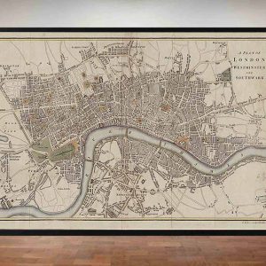 Baker’s Old Plan of London, Westminster and Southwalk 1807
£35.95 – £49.95
Baker’s Old Plan of London, Westminster and Southwalk 1807
£35.95 – £49.95
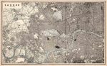
 Historical Map of London 1836
£39.95 – £49.95
Historical Map of London 1836
£39.95 – £49.95
Cram’s Old Map of London 1893
£39.95 – £159.95
Cram’s Old Map of London 1893
£39.95 – £159.95