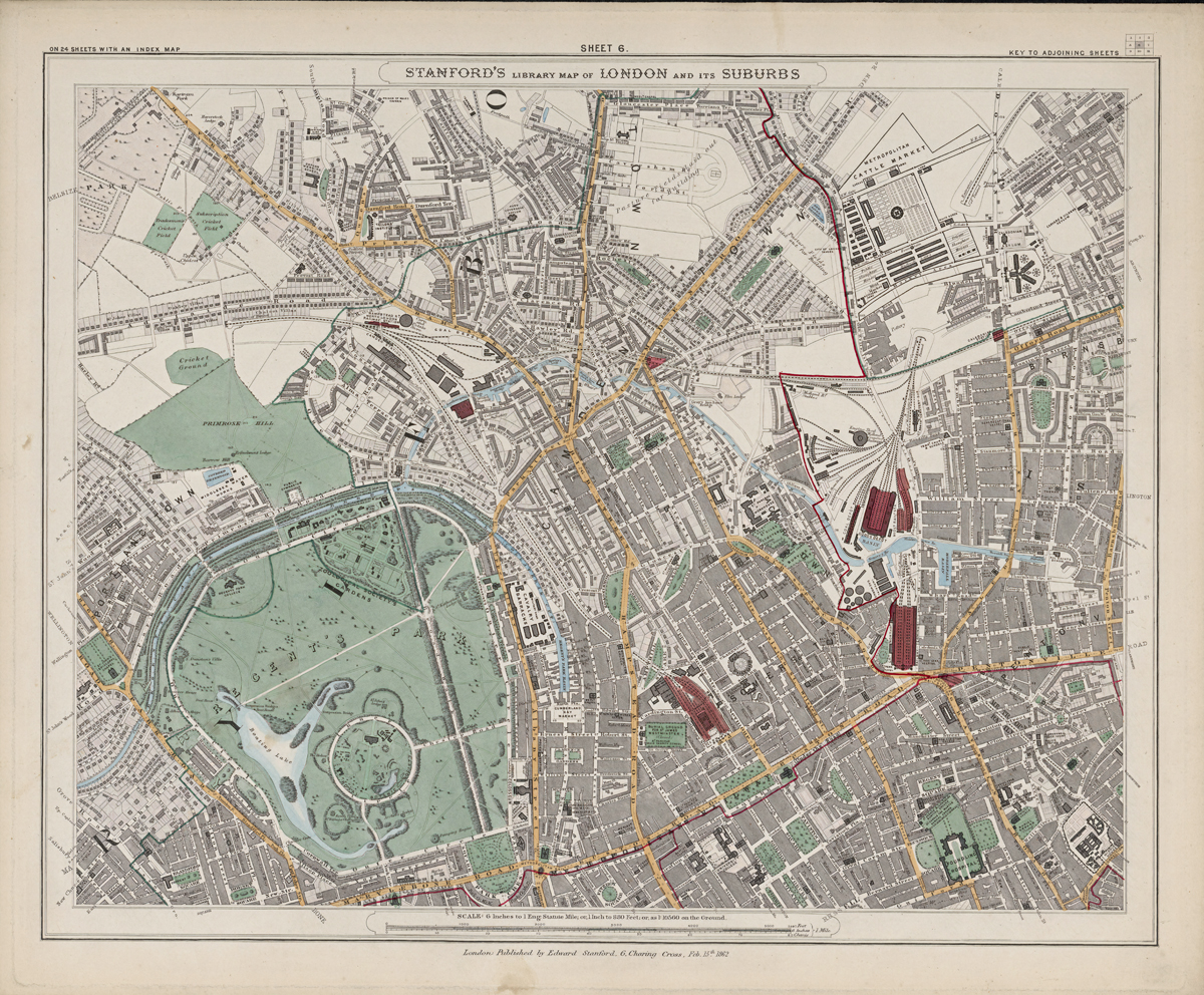
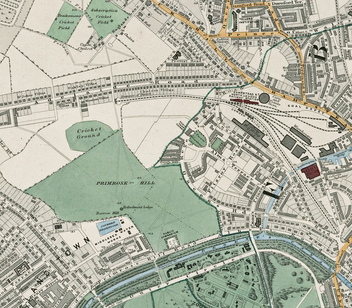
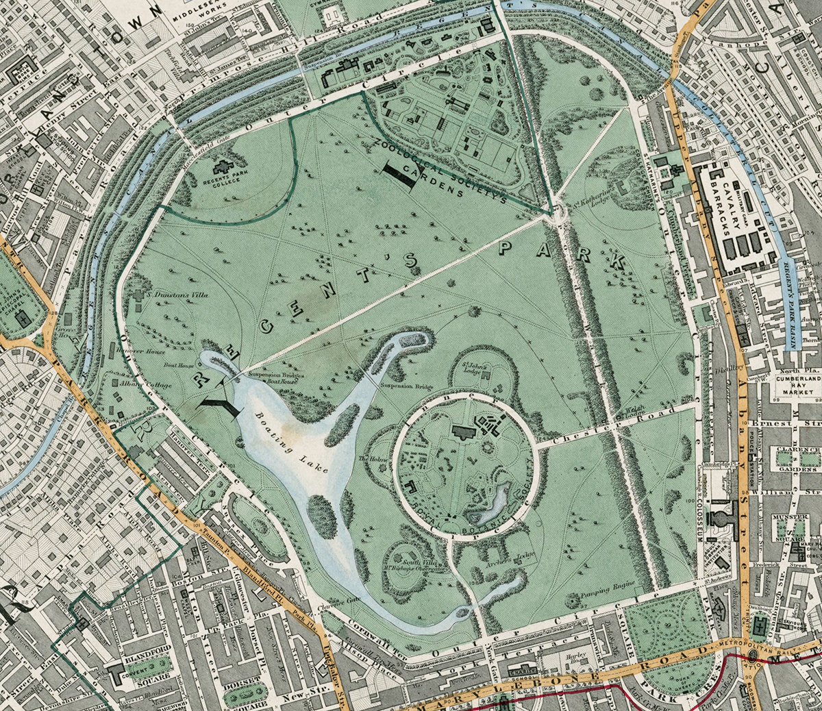
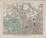
Sheet 6 of Stanford’s Library Map of London and Its Suburbs records central north-west London in 1862, covering Regent’s Park, St John’s Wood, Camden Town, Marylebone and adjoining districts. It captures a part of London where grand planned parkland, established residential streets and major railway approaches already sat side by side.
Map Details
- Original title: Stanford’s Library Map of London and Its Suburbs
- Sheet: 6 of 24
- Publisher: Edward Stanford
- Published: London, 15 February 1862
- Scale: Six inches to one mile, approximately 1:10,560
- Area shown: Regent’s Park, Primrose Hill, St John’s Wood, Camden Town, Marylebone and adjoining districts
- Orientation: North at the top
- Original appearance: Printed linework with hand-coloured roads, water, boundaries and open ground
Regent’s Park, Primrose Hill and St John’s Wood
Regent’s Park dominates the centre of the sheet, with its formal drives, lake, planted grounds and surrounding terraces clearly defined. Immediately to the north, Primrose Hill remains a broad open space, while St John’s Wood shows the distinctive pattern of villas and streets that had developed beyond the older centre of London.
Camden Town and Marylebone are much more densely built, providing a striking contrast with the parkland and more spacious residential districts nearby.
Railways and the Northern Approaches to London
The railway approaches to Euston and King’s Cross are among the most important features of the sheet. Their lines, yards and associated infrastructure show how rapidly rail transport was reshaping the northern edge of central London by the early 1860s.
Postal and Administrative Detail
The map preserves the postal and parish geography of the period, including the large district lettering and coloured boundary lines used to distinguish administrative divisions before the modern borough system.
Modern Postcode Coverage
The area shown broadly corresponds with parts of:
- NW1 – Camden Town, Regent’s Park and parts of Marylebone
- NW8 – St John’s Wood
- W1 – Marylebone and the south-western edge
- WC1 – Euston and the south-eastern edge
Modern postcode boundaries do not precisely follow the historic divisions shown on the map.